Snow in Florida 2026: Everything You Need to Know About the Sunshine State’s Historic Winter Weather
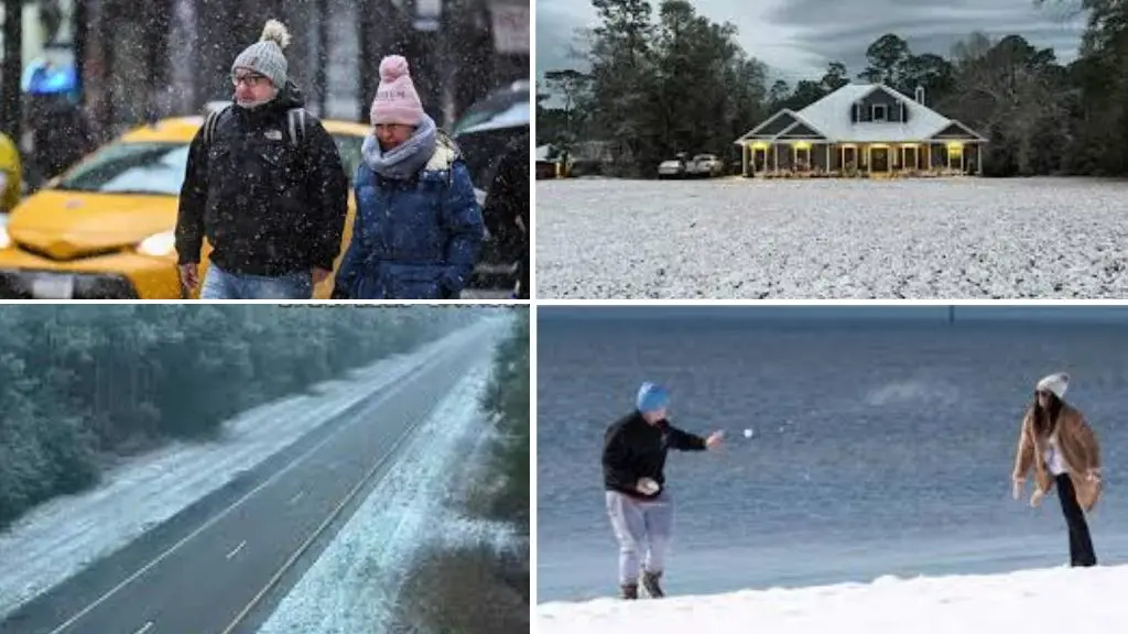
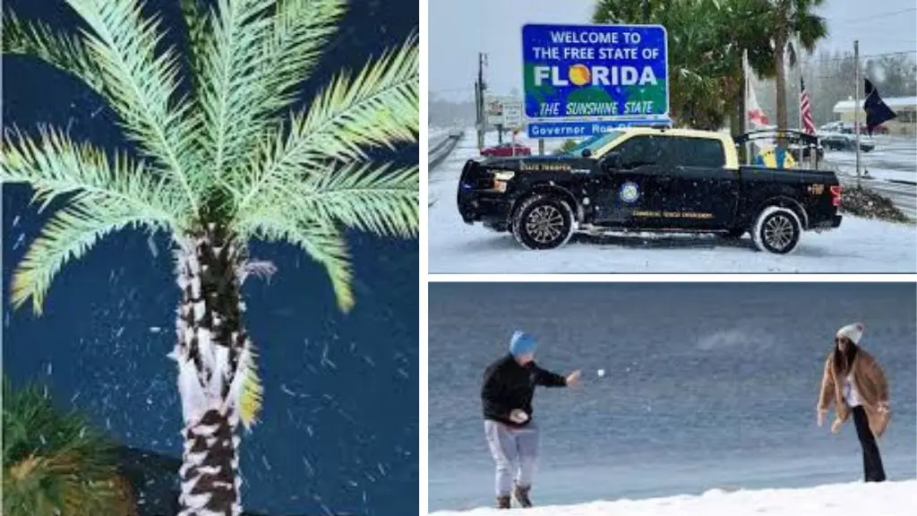
Snow in Florida 2026: On Sunday morning, January 18, 2026, residents across Florida’s Panhandle woke up to a sight that should theoretically be impossible: snowflakes falling from the sky, dusting palm trees, lawns, and cars with white powder. For the second year in a row, the Sunshine State experienced winter weather that defied all expectations, creating a meteorological phenomenon that has experts questioning whether this is a new pattern or simply an extraordinary coincidence.
Snow in Florida 2026: What Actually Happened?
Timeline of Events
The snow began falling in the early morning hours around 4 a.m. local time, with flurries starting to dust the ground just before 8 a.m. Eastern time in the Florida Panhandle. Videos and photos showed the snow beginning to hit the ground along the Interstate 10 corridor north of Fort Walton Beach.
By 9 a.m., news crews were reporting live from Chipley, Florida, where the white fluff was making its way further into the state. However, unlike last year’s historic storm, this event was considerably more modest.
Affected Areas
The 2026 snowfall primarily impacted:
- Western Florida Panhandle: Pensacola, Milton, and surrounding areas
- North Florida: Chipley, Marianna, and areas along the Florida-Georgia border
- Jackson County: Specifically northwest of Tallahassee
Jackson County was placed under a Winter Weather Advisory, where snow could accumulate up to one inch.
Accumulation Amounts
Accumulations were light, generally less than an inch, but enough to thrill Floridians. The National Weather Service confirmed that accumulation was generally light and confined mainly to grassy areas and elevated surfaces rather than roads and pavements.
Forecasters had predicted anywhere from a trace to 3 inches depending on location, with some models suggesting 1-2 inches in places like Milton and Pensacola. However, the actual accumulation fell on the lower end of predictions.

The Meteorological Setup: How Snow Happens in Florida
The Perfect (Rare) Conditions
For snow to fall in Florida requires an extraordinarily specific set of conditions:
- Arctic Air Mass: A strong Arctic cold front pushing through the state, combined with an area of low pressure, created the right setup for wintry weather near the Florida-Georgia line.
- Gulf Moisture: The flurries were due to a strong cold front colliding with moisture from the Gulf of Mexico, creating ideal conditions for frozen precipitation.
- Timing: The moisture and cold air must collide at precisely the right moment. A difference of just a few hours can result in cold rain instead of snow.
- Temperature: Temperatures needed to be cold enough for snow, typically at or below freezing at ground level.
Why Is Earth Spinning Faster? Facts You Must Know
Why Snow Rarely Sticks in Florida
Even when snowflakes fall, several factors work against accumulation:
- Ground Temperature: Florida’s ground is typically too warm for snow to accumulate, causing flakes to melt on contact with pavement and roads
- Solar Radiation: The Florida sun quickly melts any accumulation that does occur
- Humidity: High humidity levels can prevent snow from forming or cause it to melt rapidly
The Historic Context: Florida’s Snow History
The 2025 Record-Breaking Storm
On January 21-22, 2025, a powerful winter system brought record-breaking snow to the western Panhandle, with Pensacola measuring 7.6 inches and Milton seeing 9-10 inches, the heaviest snowfall ever recorded in Florida.
That storm was truly unprecedented. It shut down Interstate 10 for several hours, closed schools for four days, and gave many Florida residents their first real snow experience. The previous record for Pensacola had been just 3 inches, set way back in 1895.
Historical Snow Events in Florida
There have been more than 80 instances of snowfall in Florida documented since 1886. Notable events include:
- January 19, 1977: Snow fell in Miami and Fort Lauderdale after a powerful cold front dropped temperatures below freezing, marking the only time snow had ever been reported in Miami. This event caused severe damage to Florida’s citrus and vegetable industries.
- December 1989: A dusting of up to 1 inch of snow fell along the Interstate 4 corridor, affecting areas like Ocala and The Villages.
- January 2018: A light dusting fell across parts of North Florida.
The Unprecedented Nature of Back-to-Back Snow
Records show the Tallahassee area has never seen measurable snowfall in back-to-back years since weather records began in 1893. This makes the 2025-2026 consecutive snow events truly historic and essentially unheard of for the region.
The Science Behind the Pattern: Polar Vortex Disruption
What is the Polar Vortex?
The polar vortex is a spinning mass of frigid air that normally stays locked around the Arctic region. When this system remains stable, Arctic air stays confined to the far north.
The 2026 Disruption
Below-average temperatures were being forecast for the Central and Eastern U.S. this weekend into early next week, with subzero wind chills forecast from the Plains to the Midwest and Northeast.
A stratospheric warming event essentially displaced the polar vortex, shoving cold air masses further south than usual. This resulted in Arctic blasts sweeping deep into the Southeast, reaching areas completely unprepared for such cold.
Regional Impact Beyond Florida
The unusual snow came amid a broader winter storm that stretched over 1,500 miles, bringing accumulating snow from the Gulf Coast to Maine. The system affected:
- Southern Georgia: Winter storm warnings with several inches of heavy, wet snow expected
- The Carolinas: Heavier snow anticipated by evening
- Midwest and Northeast: Snow squalls creating whiteout conditions in areas like northeastern Ohio
Impact on Florida Communities
Infrastructure Challenges
Florida is fundamentally unprepared for snow. The state lacks:
- Snow plows (though the state does have nearly a dozen)
- Salt and sand for roads
- Winter driving experience among residents
- Cold-weather building codes
When snow falls, even light accumulations can create hazardous conditions because:
- Roads become slippery without treatment
- Drivers lack experience with winter conditions
- Emergency services aren’t equipped for winter weather responses
Public Response
The public reaction to snow in Florida is always remarkable:
- Excitement: For many residents, especially children, it’s a once-in-a-lifetime experience
- Confusion: Pets and wildlife react strangely to the white stuff
- Social Media Frenzy: Photos and videos flood social platforms as residents document the rare event
- Early Risers: Many people had to wake up before dawn to catch the snow before it melted
Economic and Agricultural Concerns
While the 2026 event was minor, the 1977 snowstorm provides a cautionary tale. That cold front caused severe damage to Florida crops, leaving the state’s citrus and vegetable industries nearly wiped out, with some 150,000 migrant workers losing their jobs.
How Extreme Weather Affects Your Garden (And How to Protect It)
Climate Questions: Is This the New Normal?
The Pattern Debate
The occurrence of snow in Florida two years in a row raises important questions:
- Is this a pattern or an anomaly? Most meteorologists lean toward anomaly, but two consecutive years is statistically unusual
- Climate change connection: Some scientists point to these events as examples of how climate change creates more extreme and erratic weather, not just warmer averages
- Future predictions: Whether January 2027 will bring a third occurrence remains uncertain
What Meteorologists Are Saying
Meteorologist Kristian Oliver noted, “On average we have an event like this maybe every few years. But having two, back to back, I’d say is pretty anomalous for the area”.
The scientific consensus suggests that while climate patterns are becoming increasingly unpredictable, consecutive snow events in Florida remain exceptionally rare rather than indicative of a permanent shift.
Comparing 2025 vs. 2026: A Study in Contrasts
The Differences
2025 Storm:
- 7.6 to 10 inches of accumulation
- Interstate 10 shut down
- Schools closed for 4 days
- Widespread impacts lasting several days
- True blizzard conditions in some areas
2026 Event:
- Less than 1 inch accumulation
- Brief duration (2-3 hours)
- Melted quickly by mid-morning
- Minimal disruption
- Required early risers to witness
The Similarities
- Both occurred in mid-to-late January
- Both affected the western Panhandle primarily
- Both resulted from polar vortex disruptions
- Both surprised even experienced meteorologists with their southern reach
Safety and Preparation: What Floridians Should Know
The “5 P’s” of Cold Weather Safety
Florida emergency management officials recommend:
- People: Check on elderly neighbors and those vulnerable to cold
- Pets: Bring animals indoors or provide adequate shelter
- Pipes: Protect plumbing from freezing
- Plants: Cover sensitive vegetation
- Preparation: Have supplies ready for potential power outages
Winter Weather Advisories
When snow is possible, the National Weather Service issues:
- Winter Weather Advisories: For areas expecting light accumulations
- Winter Storm Warnings: For areas expecting more significant impacts
- Freeze Warnings: For areas facing damaging cold temperatures
Travel Considerations
If snow is forecast in North Florida:
- Avoid unnecessary travel
- Allow extra time for trips
- Expect slippery roads and bridges
- Remember that most Florida drivers have zero experience with snow
Looking Forward: What to Expect
Short-term Forecast
Following the January 18 snow event, Florida faced:
- Continued cold temperatures through early next week
- Freeze warnings extending from Orlando to Vero Beach
- Overnight lows in the 20s and 30s
- Wind chills making it feel even colder
Long-term Uncertainty
Predicting future snow events in Florida remains nearly impossible. The specific conditions required are so rare and the climate patterns so variable that even advanced modeling struggles to forecast beyond a few days.
The Cultural Phenomenon: Snow in the Sunshine State
Why It Captivates
Snow in Florida captures imagination because it represents:
- The Impossible Made Real: It challenges our understanding of geography and climate
- Shared Experience: Entire communities witness something extraordinary together
- Childhood Wonder: Even adults experience childlike excitement
- Natural Beauty: The contrast of snow on palm trees and tropical vegetation
Media Coverage
The 2026 event generated significant media attention, though less than 2025’s historic storm. News crews chased the snow across the Panhandle, providing live coverage and creating a sense of shared statewide (and national) interest.
Conclusion
The snow that fell across Florida’s Panhandle on January 18, 2026, serves as a fascinating reminder that nature doesn’t always follow the script we expect. While far less dramatic than 2025’s record-breaking storm, the 2026 event was historically significant simply for occurring at all.
For Florida residents, it reinforced an important lesson: in weather, as in life, expect the unexpected. Whether this represents a new pattern or simply an extraordinary statistical fluke remains to be seen. What’s certain is that Floridians will be watching future January forecasts with a bit more attention, wondering if the impossible might happen again.
As climate patterns continue to shift and polar vortex disruptions become better understood, the story of snow in Florida will continue to evolve. For now, it remains a rare, beautiful, and slightly surreal experience that brings communities together in wonder at the natural world’s capacity to surprise us.
For the most up-to-date weather information and forecasts, always consult the National Weather Service and local meteorologists. Stay safe, stay warm, and if you’re lucky enough to see snow in Florida again, enjoy every flake.


