
Powerful Coastal Storm to Dump Up to 12 Inches on NYC This Weekend
A powerful nor’easter is set to bring heavy snow, strong winds, and hazardous travel conditions to New York City and the tri-state area from Sunday afternoon through Monday morning. The latest weather forecasts show up to 12 inches of snow possible in the five boroughs, with significantly higher amounts expected on Long Island. Here’s everything you need to know about this major winter event.
Forecasts now show up to a foot of snow expected for the five boroughs, with the potential for even higher amounts in some areas. The city could see 6-10 inches, while northwestern locations may only see 4-8 inches.
Most Likely Range: 6-10 inches
Highest Potential: Up to 12 inches in some areas
Long Island (Highest Impact Area)
Some farther east on Long Island and down the Jersey Shore could see more than a foot of snow before the storm is over. In general, south and east of the city is where the highest likelihood of seeing snow totals of more than a foot.
Long Island (Nassau County): 6-10 inches
Long Island (Suffolk County): 10-15+ inches (highest amounts)
Surrounding Areas
Totals may be a little lower farther north and west, with the Hudson Valley, North Jersey and Connecticut in the 5-8 inch range.
Northern New Jersey, Lower Hudson Valley, Connecticut: 6-10 inches
Upper Hudson Valley and Far Northwestern New Jersey: 4-8 inches
Central Jersey and Jersey Shore: 6-10 inches inland; 10-15 inches along the coastline
Snowfall Probability for NYC
Greater than 6 in 21%, 3-6 in 24%, 1-3 in 35%, A coating to an inch 16%, Little to no accumulation 4%
Current Weather Alerts and Watches
Winter Storm Watch in Effect
The National Weather Service has issued a Winter Storm Watch for the five boroughs, set to go into effect on Sunday at 6 a.m.
Status: Winter Storm Watch
Effective: Sunday, February 22 at 6:00 AM through Monday, February 23 at 6:00 PM EST
Probability: Winter Storm Warning likely as storm approaches
First Alert Weather Day
A winter storm watch and a First Alert Weather Day are in effect for the Tri-State Area, starting Sunday morning through Monday afternoon.
Hour-by-Hour Forecast Timeline
Saturday, February 21 (Today) – Final Preparation Day
After what is expected to be a remarkably nice Saturday featuring some sun and milder temperatures reaching the mid-to-upper 40s, colder air will rush back in on Sunday in advance of the next storm.
Conditions: Partly sunny to mostly sunny
High Temperature: Mid-to-upper 40s°F
Action Needed: Stock supplies, prepare vehicles, charge all devices
Sunday Morning – February 22: 7:00 AM to 1:00 PM
7 a.m.-1 p.m. Sunday: A vigorous area of low pressure starts to rapidly develop off the Mid-Atlantic coastline. As a result, snow moves into the region from south to north. It will be light to moderate at times. Along the coast, plain rain is likely.
Conditions: Light to moderate snow developing; rain along coast
Snowfall Rate: 0.5-1 inch per hour
Temperature: Dropping from 40s to 30s°F
Wind: Northeast 15-20 mph
Lightning Without Rain – The Eternal Storm of Catatumbo, Venezuela
Sunday Afternoon: 1:00 PM to 7:00 PM
Snow becomes more consistent across the region.
Conditions: Moderate to heavy snow
Snowfall Rate: 0.5-1.5 inches per hour
Temperature: Low 30s°F
Wind: Northeast 20-30 mph
Sunday Evening to Monday Morning: Peak Storm Period (7:00 PM Sunday – 10:00 AM Monday)
1 p.m. Sunday-10 a.m. Monday: As the area of low pressure strengthens further, it then becomes a nor’easter as it moves up the coast. Any leftover rain will chance over to snow for everyone. Snow will become very heavy at times and may fall at rates of 1-2 inches per hour. Winds will also increase, especially at the coast, gusting between 30-50 mph at times.
Conditions: Heavy to very heavy snow; nor’easter develops
Snowfall Rate: 1-2 inches per hour (heaviest period)
Temperature: Mid-20s to low 30s°F
Wind: Northeast 30-40 mph with gusts 30-50 mph
Visibility: Significantly reduced due to heavy snow and blowing snow
Monday Morning: 10:00 AM – 1:00 PM (Final Heavy Band)
10 a.m.-1 p.m. Monday: The storm will start winding down, but snow could still fall moderately at times. It may not be completely done until the mid-to-late afternoon hours.
Conditions: Moderate snow tapering to light
Snowfall Rate: 0.5-1 inch per hour
Temperature: Low 20s°F
Wind: Northeast 25-35 mph with gusts to 40+ mph
Monday Afternoon: 1:00 PM – 5:00 PM (Snow Ends)
Conditions: Light flurries to snow ending
Temperature: Around 20°F
Wind: Decreasing through the afternoon
Wind and Coastal Impacts
Wind Speed Details
Additionally, winds will gust between 30-50 mph during the storm, so blowing snow will be a problem, particularly along the coast.
Peak Wind Gusts: 30-50 mph, strongest along coast and Long Island
Inland Wind Gusts: 30-40 mph typical
Coastal Wind Gusts: 40-50 mph possible
What to Do During a Freeze Warning: A Complete Preparation and Protection Guide
Additional Impacts
In addition to snow, the strengthening storm offshore can also bring with it gusty winds and minor to moderate coastal flooding as well.
Blizzard Conditions Possible
Blizzard conditions, when winds are at or above 35 mph combined with falling or blowing snow for at least three hours, could occur, especially in Suffolk County.
What This Nor’easter Means
A Classic Nor’easter Developing
The latest forecast models are in, and it shows the New York City area getting hit by another weekend winter storm that is shaping up to be a classic nor’easter.
Models that previously showed the system farther offshore (like the European model) moved Friday morning, showing it hugging the coastline more. This shift means higher snow totals for the region than earlier forecasts suggested.
Why Totals Increased
Computer models only began to indicate in the past 12-24 hours that snow “would be on the heavier side”. A nor’easter that stays closer to the coast brings significantly more snow and stronger impacts than one that tracks out to sea.
Temperature Marginal for Snow
James Tomasini, a meteorologist with the National Weather Service in New York, noted that “the temperatures this time around will be much more marginal,” meaning some areas could briefly see rain mixing with snow, particularly early in the event along the coast.
NYC Area Impacts and Disruptions
Transportation
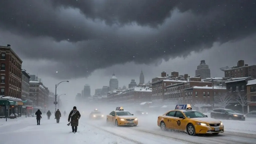
A powerful coastal storm is expected to bring widespread impacts to the Tri-State area from Sunday afternoon through Monday morning, with heavy snow, strong winds and hazardous travel likely.
Travel Sunday night will be a mess, with heavy snow and gusty wind. The morning commute on Monday will be terrible, too.
Recommendation: “Be ready to adjust travel plans Sunday and Monday morning, including caregiving schedules,” the city’s Emergency Management agency posted. “Avoid unnecessary travel Sunday and Monday morning if you can to allow snow operations crews to operate”.
Roads and Highways
Roads will start to deteriorate, especially south of I78 and across Long Island, where steadier bands develop first.
Public Transportation Delays
While the snow will be coming to an end, the winds will lead to blowing snow and reduced visibility, making roads awful to navigate.
City Sanitation Response
New York City Mayor Zohran Mamdani said pre-snow operations will start Saturday, with plows being mounted, salt spreaders being loaded and crews being prepared. Sunday, Department of Sanitation workers will work 12-hour shifts. A Code Blue will be in effect.
Forecast Uncertainty and What Could Change
Model Disagreements Still Exist
Forecast models remain at odds on how much snow the region will get, but the general consensus is north and west of New York City will see at least 6-10 inches, while points south and east could get up to 15 inches.
How quickly a storm strengthens and subsequently how close to the coast the storm tracks will determine the exact amount of snow and extent of slippery conditions in the New York City area from Sunday to Sunday night.
Key Variables
If the storm is stronger and tracks a bit farther west, much heavier snow may fall. Should the storm shift farther to the east, accumulations may be generally light in the region.
A small jog in the storm track could still change totals, but trends now clearly point to a higher-impact event.
Post-Storm Outlook
Clearing Expected Tuesday
The storm system will begin pulling away Monday afternoon, so conditions will begin to improve, with dry skies and sunshine taking over Tuesday.
Tuesday: Dry skies, sunny, cold
Temperature: Around 25-30°F
Wind: Decreasing through the day
Official Recommendations and Warnings
New York City Emergency Management
Be sure to travel smart and leave yourself ample time to get to where you’re going,” Gov. Kathy Hochul said in a statement. “Pack your car with emergency essentials and drive slowly as slick roadways can be dangerous”.
Steps to Prepare
- Stock essential supplies (food, water, medications)
- Charge all electronic devices
- Fill vehicle gas tank to at least half full
- Prepare emergency kit for vehicle
- Check heating system
- Plan to work from home Monday if possible
Avoid Unnecessary Travel
Officials are warning New Yorkers to take precautions and expect travel delays.
Where to Monitor for Updates
Official Weather Sources
- National Weather Service: weather.gov/okx
- NBC New York: nbcnewyork.com
- CBS New York: cbsnews.com/newyork
- ABC7 New York: abc7ny.com
- FOX 5 New York: fox5ny.com
Real-Time Alerts
Enable push notifications on weather apps and follow local meteorologists on social media for the latest updates as the storm approaches and evolves.
Context: This Season’s Snow Activity
The total snowfall the city has seen so far is about 21 inches, which is nearly double what the average amount is. This upcoming nor’easter will add significantly to that total.
Both December and January saw over the average of their typical snowfall amounts, making this already an unusually snowy winter season.
Summary: What You Need to Know
✓ Snowfall: 6-10 inches NYC; up to 12+ inches possible; 10-15 inches Long Island
✓ Timing: Sunday afternoon through Monday afternoon
✓ Peak: Sunday night into Monday morning (heaviest rates 1-2 inches/hour)
✓ Winds: 30-50 mph with gusts up to 50 mph
✓ Blizzard Potential: High for Long Island, possible for NYC and coast
✓ Travel: Avoid Sunday evening and Monday morning
✓ Alerts: Winter Storm Watch; Warning likely
✓ Clearing: Tuesday with sunny, cold weather
Final Advice
This is a significant winter weather event that requires preparation and caution. Use Saturday to finalize preparations, avoid travel Sunday evening through Monday morning, and monitor the National Weather Service for any updates or alert upgrades as the storm approaches.
The combination of heavy snow, strong winds, and blowing snow will create hazardous conditions for travel. The safest and smartest decision is to remain home during the peak storm hours and allow snow removal operations to proceed unimpeded.