Tornado Watch Issued for Columbia Area as Severe Thunderstorms are Forecast
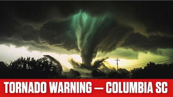
Tornado Warning Columbia SC: The skies over Columbia, South Carolina turned dangerous this morning — and thousands of residents woke up to one of the most alarming alerts their phones can receive.
A tornado warning was issued for Columbia SC and surrounding areas on Thursday, March 12, 2026, as a powerful cold front swept across the Midlands, bringing with it severe thunderstorms, radar-indicated rotation, and the very real threat of a tornado touching down in one of the most populated regions of the state. If you are in the Columbia area right now — read this before you do anything else.
A Tornado Watch has been issued for the Columbia, South Carolina area as forecasters warn that severe thunderstorms capable of producing tornadoes are expected to develop across the region. Unlike a Tornado Warning — which means a tornado has already been detected and immediate action is required — a Tornado Watch means atmospheric conditions are dangerously favorable for tornado formation, and residents should stay alert, monitor weather updates closely, and be fully prepared to move to shelter the moment a warning is issued for their specific location.
The National Weather Service issued the watch as a powerful cold front pushes through central South Carolina, bringing with it the threat of damaging wind gusts reaching up to 60 mph, large hail, heavy rainfall, and the possibility of brief but dangerous tornadoes touching down across Columbia, Lexington, Richland County, and surrounding Midlands communities.
If you are in the Columbia area right now — do not wait for a warning to start preparing. A watch means the danger is already building. Your window to act is right now.
Tornado Warning Columbia SC
The National Weather Service office in Columbia issued an active tornado warning for parts of the Midlands on the morning of Thursday, March 12, 2026.
The National Weather Service confirmed a tornado warning for Southern Fairfield County, Southeastern Newberry County, North Central Lexington County, and Northwestern Richland County — the county that contains the city of Columbia itself.
At 9:38 AM EDT, a severe thunderstorm capable of producing a tornado was located over Dreher Island State Park — approximately 10 miles northwest of Highway 6 at Lake Murray Dam — moving east at 35 mph.
The hazard was confirmed as a tornado with the source listed as radar-indicated rotation. The National Weather Service warned that flying debris will be dangerous to those caught without shelter, mobile homes will be damaged or destroyed, and damage to roofs, windows, and vehicles is expected.
According to AccuWeather, the tornado warning for Richland County — which includes Columbia — was active from 9:38 AM EDT to 10:15 AM EDT on Thursday, March 12.
A First Alert Weather Day was declared by WIS News as a strong cold front arrived from the west, bringing a line of rain, thunder, and gusty winds through the Midlands.
Is the Tornado Warning Affecting Lexington SC and Nearby Areas?
Yes — and the scope of this weather event extends well beyond Columbia city limits.
At one point during the morning, tornado warnings were simultaneously in effect for Lexington, Richland, Fairfield, Newberry, Saluda, and Orangeburg Counties — covering the cities of Columbia, Irmo, Batesburg-Leesville, and the entire Lake Murray area.
A separate tornado warning was issued for West Central Lexington County, Southeastern Saluda County, and North Central Aiken County, with a severe thunderstorm capable of producing a tornado located over Ridge Spring near Batesburg-Leesville, moving east at 45 mph.
Locations specifically impacted by the tornadic thunderstorm in Lexington County include Camp Kinard, South Shore Marina, Fredonia, Gilbert, Hollow Creek Public Park, Siesta Cove Marina, Hibernia, Summit, Murray, and Kneece.
For residents of Lexington SC, the message from the National Weather Service was identical — take cover immediately. Do not wait to see the storm. Do not go outside. Treat every tornado warning as a direct threat to your immediate safety.
Tornado Watch vs Tornado Warning — What Is the Difference?
This is one of the most important distinctions in weather safety — and one that too many people get wrong. Understanding it could save your life.
A Tornado Watch means that weather conditions are favorable for severe thunderstorms that may produce tornadoes in and near the watch area. A watch covers a large geographic area and can last several hours. It does not mean a tornado has been spotted or detected. It means you should stay alert, monitor weather updates, and be ready to act immediately if conditions worsen.
A Tornado Warning means a tornado has been detected — either visually confirmed on the ground or indicated by radar rotation — and is imminent or already occurring in the warned area. A warning is issued for a specific, smaller geographic area and requires immediate action. When a tornado warning is issued for your location, you do not have time to gather belongings or wait for more information. You move to safety right now.
A Tornado Watch for most of central South Carolina and parts of Georgia was in effect until 1:00 PM EDT — meaning even after individual tornado warnings expire, the broader atmospheric conditions remained dangerous throughout the morning and early afternoon.
A strong cold front sparked the line of showers and storms moving through the Midlands, with a few storms capable of producing damaging wind gusts, large hail, and a brief tornado or two.
Weather Conditions Across Columbia SC and Nearby Cities
The severe weather event on March 12 affected a wide corridor across the central South Carolina region — and its effects were felt in cities well beyond Columbia and Lexington.
Columbia, SC — Northwestern Richland County under active tornado warning. Residents in Columbia, Irmo, and Ballentine were directly in the path of the warned storm system.
Lexington, SC — North Central Lexington County under active tornado warning. The Lake Murray area and surrounding communities on high alert throughout the morning.
Batesburg-Leesville, SC — Named directly in National Weather Service warning communications as a location in the path of the tornadic thunderstorm moving east at 45 mph.
Irmo, SC — Specifically named in NWS alert communications as being in the direct path of the Columbia-area storm around 9:45 AM EDT.
Augusta, Georgia — A Severe Thunderstorm Warning was issued for parts of east central Georgia during the same weather event, with the storm system continuing to push east. Augusta weather was affected by the same cold front producing the South Carolina tornado threat, with 60 mph wind gusts reported.
Charlotte, North Carolina — Charlotte weather forecasters were monitoring the system’s northward trajectory. While Charlotte was not under immediate tornado threat during the Columbia event, the broader system driving these storms extended across a wide portion of the Carolinas and Georgia.
Behind the cold front, temperatures across Columbia are expected to drop quickly, with a chilly Friday morning to follow. Friday afternoon will be cooler with sunshine and highs in the mid to upper 60s. The weekend brings nicer conditions with highs in the 70s on Saturday before another cold front approaches Sunday bringing more rain chances.
Safety Tips During a Tornado Warning
When a tornado warning is issued for your area, every second matters. Here is exactly what to do:
Go to your safe place immediately. The safest location during a tornado is an interior room on the lowest floor of a sturdy building — away from all windows. A basement is ideal. If you do not have a basement, go to an interior bathroom, closet, or hallway.
Get under something sturdy. If possible, get under a heavy table or desk and protect your head and neck with your arms. Flying debris is the number one cause of tornado injuries and deaths.
If you are in a mobile home — get out now. Mobile homes provide almost no protection against tornado-force winds even if they are anchored. Leave immediately and find the nearest sturdy building.
The National Weather Service instructs that if you are outdoors, in a mobile home, or in a vehicle, you should move to an interior room or closet on the lowest floor of a sturdy building immediately when a tornado warning is issued.
If you are in a vehicle and cannot reach a sturdy building, do not try to outrun a tornado on roads. Drive at right angles to the tornado’s path if possible, or abandon the vehicle and lie flat in a low-lying ditch with your hands covering your head.
Do not open windows. The old advice about opening windows to equalize pressure is completely false and wastes precious time that should be spent getting to shelter.
Stay away from bridges and overpasses. Wind speeds under bridges are actually higher and more dangerous than in open areas — never shelter under a bridge during a tornado.
Have a way to receive alerts. Download the FEMA app or enable Wireless Emergency Alerts on your phone. A NOAA Weather Radio is the most reliable source of official warnings. Sign up for your county’s emergency alert system.
Wait for the all-clear. Do not emerge from shelter until the National Weather Service has officially issued an all-clear or the warning has expired. Tornadoes can change direction unpredictably.
How South Carolina Is Preparing for Severe Weather Season
Today’s tornado warning in Columbia SC did not arrive in isolation — it came during a week of heightened statewide awareness.
South Carolina Severe Weather and Flood Safety Week is officially recognized as March 8 through 14, 2026 — the same week as today’s active tornado warnings across the Midlands.
On Wednesday, March 11 at 9:00 AM, the National Weather Service conducted a statewide tornado drill in close coordination with the South Carolina Broadcasters Association, activating the State Emergency Alert System and NOAA tone-alert weather radios across the state.
The South Carolina Emergency Management Division and the National Weather Service jointly sponsor Severe Weather Preparedness Week to remind people that severe storms, tornadoes, and flash floods are significant hazards in South Carolina — and that having a plan in place before a storm arrives is what saves lives.
The timing of today’s event — just one day after a statewide drill — is a sobering reminder that tornado preparedness in South Carolina is not a theoretical exercise. It is a practical necessity.
Conclusion
The tornado warning issued for Columbia SC and Lexington SC on March 12, 2026 serves as a powerful reminder that severe weather in South Carolina is unpredictable, fast-moving, and dangerous. While many of today’s warnings have now expired, a Tornado Watch remains in effect for central South Carolina until 1:00 PM EDT — meaning the threat is not over.
Stay alert. Stay informed. Follow the National Weather Service at weather.gov/cae for the most current and authoritative updates on weather columbia sc and the broader Midlands region. And if another warning is issued today — take cover immediately. Every warning is real. Every second matters.
All warning information sourced directly from the National Weather Service Columbia, AccuWeather, WLTX, WIS News, ABC Columbia, and WACH Fox as of March 12, 2026 at 10:00 AM EDT. This is a developing weather situation — conditions may change rapidly. Always follow official NWS guidance for your specific location.