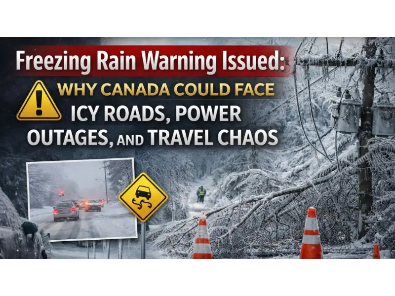
Freezing Rain Warning Issued: Why Canada Could Face Icy Roads, Power Outages, and Travel Chaos
Ottawa users, it will be a slippery week to begin with! Environment Canada has placed an orange-level freezing rain warning on the Ottawa-Gatineau region and much of eastern Ontario. Substantial ice accumulation is expected to begin on Sunday night (December 28) and extends to the Monday morning (December 29). This may cause unsafe traveling, electricity shortages and unsafe surfaces.
Which areas are most at risk for icing? The highest risk areas include Innisfil, Keswick, Newmarket, Aurora, Minden, Haliburton, Orillia, Uxbridge, and Fenelon Falls. These locations may see prolonged freezing rain before conditions improve.
What is the weather going to be like on Monday? The forecast of Monday consists of cloudy skies, rain showers that might develop into snow, and strong winds of between 30 and 50 km/h with the gusts of maybe, 70 km/h, which may contribute to difficult conditions.
Here’s everything you need to know about the freezing rain event, its impacts, and how to stay safe.
Freezing Rain Warning Issued for Ottawa and Eastern Ontario
Environment Canada upgraded its alert to an orange warning, signaling high-impact weather with potential widespread disruption.
Key Warning Details
- What: Prolonged freezing rain, possibly mixed with ice pellets
- Ice Accretion:
- Ottawa: 15–20 mm of ice (some models suggest 10–15 mm)
- Timing:
- Begins after 7 PM Sunday, December 28
- Continues overnight into Monday morning
- May change to rain or flurries by Monday afternoon as temperatures rise
- Cause:
- A rapidly intensifying low-pressure system over the Great Lakes, forcing warm air above freezing temperatures at altitude while surface temperatures remain below zero
- Areas Affected:
- Ottawa North–Kanata–Orléans
- Ottawa South
- Gatineau and the wider Outaouais
- Cornwall, Pembroke, Renfrew, Perth, Gananoque, Bancroft
Environment Canada strongly advises postponing all non-essential travel.
Must Read: Lightning Without Rain – The Eternal Storm of Catatumbo, Venezuela
What Is Freezing Rain and Why Is It So Dangerous?
Freezing rain occurs when rain falls through warm air aloft and freezes instantly upon contact with cold surfaces. Unlike snow, it forms a smooth, invisible layer of ice that coats:
- Roads and highways
- Sidewalks and steps
- Trees and branches
- Power lines and infrastructure
Even 10–15 mm of ice can cause widespread damage. Ottawa residents still remember the 1998 Ice Storm, when similar conditions caused massive outages lasting days. While this storm may be smaller in scale, the risks are still serious.
Expected Impacts in Ottawa
1. Dangerous Roads and Travel
- Black ice will make roads extremely slippery
- High-risk areas include Highway 417, Highway 174, bridges, and overpasses
- Collisions and major slowdowns are likely
2. Power Outages Possible
- Ice-laden branches may snap and fall onto power lines
- Hydro Ottawa crews are on standby, but outages could be prolonged
- Residents should prepare for loss of heat and electricity
3. School and Workplace Disruptions
- Possible school bus cancellations or delays Monday
- Remote work encouraged where possible
- Check OC Transpo for service disruptions
4. Flight Delays at Ottawa International Airport (YOW)
- De-icing delays likely
- Cancellations possible for early Monday flights
- Travelers should monitor Air Canada and WestJet updates
5. Pedestrian Hazards
- Sidewalks will be extremely slippery
- Slip-and-fall injuries increase significantly during freezing rain events
Online discussions, including Reddit’s r/ottawa, are already calling this a “classic Ottawa chaos storm” — freezing rain first, possibly followed by snow.
Safety Tips: How to Prepare Before the Storm
At Home
- Charge phones, power banks, and laptops
- Stock food, water, medications, and batteries
- Keep flashlights, blankets, and candles accessible
For Your Vehicle
- Ensure winter tires are installed
- Carry an emergency kit:
- Ice scraper
- Sand or traction aid
- Booster cables
- Extra warm clothing
If You Must Drive
- Reduce speed dramatically
- Increase following distance
- Avoid sudden braking or sharp turns
Outdoors
- Limit time outside
- Watch for falling branches and power lines
Pets
- Keep walks short
- Wipe paws after walks to remove salt and ice
Check on Vulnerable Neighbors
- Elderly, disabled, or isolated individuals may need assistance during outages
Weather Outlook After the Storm
- Monday afternoon: Slight warming may turn ice to rain
- Tuesday: Colder air returns with possible flurries
- No major storms immediately follow, but winter conditions remain active
Weather Alerts Explained: New Color-Coded System
Environment Canada now uses a three-tier color alert system aligned with World Meteorological Organization standards:
- 🟡 Yellow: Potentially hazardous conditions
- 🟠 Orange: Dangerous weather with high impact (current warning)
- 🔴 Red: Extreme, life-threatening conditions
Ottawa’s orange alert signals serious risk requiring preparation and caution.
Final Word: Stay Safe, Ottawa
Freezing rain is one of the most dangerous winter weather events Ottawa faces. With 15–20 mm of ice expected, residents are urged to stay home if possible, prepare emergency supplies, and monitor official updates.
👉 Check weather.gc.ca, local news, and emergency alerts for real-time updates.
FAQs
1. What kind of winter weather is affecting Canada right now?
Severe winter weather is impacting large parts of Canada, with freezing rain, heavy snow, blowing snow, and extreme cold. Environment Canada has issued multiple warnings across Ontario, Quebec, the Prairies, British Columbia, Atlantic Canada, and the North.
2. What is causing freezing rain in Ontario?
A rapidly intensifying low-pressure system moving across the Great Lakes is bringing warmer air over cold ground-level temperatures. This setup is causing rain to freeze on contact, leading to dangerous ice buildup from late Saturday through Monday morning.
3. Which areas in Ontario are most at risk?
Communities north of Toronto—such as Newmarket, Aurora, Georgina, Uxbridge, and parts of northern York Region—could see 5 to 10 millimetres of ice. Areas east of Toronto, including Cobourg and Colborne, are also under advisories.
4. Why is freezing rain so dangerous?
Freezing rain creates a layer of ice on roads, sidewalks, trees, and power lines. This can lead to slippery driving conditions, increased falls, falling tree branches, and power outages, especially when temperatures hover near the freezing mark.
5. What warnings are in place for Quebec?
Freezing rain warnings and special weather statements have been issued for Greater Montreal, Laval, Montérégie, the Laurentians, Lanaudière, and the Outaouais. Northern Quebec is also under snowfall watches due to heavy snow risks.
6. How is the rest of Canada being affected?
- Prairies (Alberta & Saskatchewan): Blowing snow, poor visibility, dangerous driving, and blizzard warnings in some areas
- British Columbia: Snow and difficult travel in interior and mountain regions
- Newfoundland and Labrador: Major winter storm with 40–60 cm of heavy snow and wind gusts up to 110 km/h
- Yukon: Extreme cold warnings with temperatures dropping near –50°C
7. What should residents do to stay safe?
Environment Canada urges people to limit outdoor exposure, avoid non-essential travel, and take precautions against frostbite and icy conditions. Weather conditions may change quickly, so staying updated with forecasts and alerts is strongly advised.
8. Will the freezing rain turn into regular rain?
Yes. As temperatures rise, freezing rain is expected to transition into rain later Sunday night. In Toronto, temperatures may reach 2°C, with rain showers becoming widespread across the GTA by midnight.


